10.11.2026 20:23
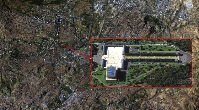
The Ministry of National Defense (MSD) shared an image of Anıtkabir taken from an altitude of 686 kilometers by the national reconnaissance satellite GÖKTÜRK-1 on the occasion of November 10, Atatürk Memorial Day. While it was stated that the image was taken by Space Command personnel, the MSD commemorated Atatürk with respect, gratitude, and mercy on the 88th anniversary of his passing.
The Ministry of National Defense (MSD) shared an image of Anıtkabir taken from an altitude of 686 kilometers by the GÖKTÜRK-1 satellite on the occasion of November 10 Atatürk Commemoration Day.
MSD: ON LAND, AT SEA, IN THE AIR AND NOW IN SPACE
In a statement made from the Ministry of National Defense's social media account, it was said:
"From an altitude of 686 km, Ankara and the heart of our Republic: Anıtkabir, imaged by Space Command personnel with our national reconnaissance satellite GÖKTÜRK-1. On the 88th anniversary of his departure from among us, we commemorate with respect, gratitude and mercy the founder of our Republic, Gazi Mustafa Kemal Atatürk, who entrusted us with our independence, the Republic and bright tomorrows. On the path opened by the Great Leader; under the guidance of science, technology and engineering, we continue to add strength to our country's power on land, at sea, in the air and now in space."