27.08.2026 09:21
At least 165 people have lost their lives in the flood and landslide disaster that struck the border line between Nepal and China's Tibet region. While a total of 1,381 people remain unaccounted for on both sides, it was stated that the disaster, initially associated with an earthquake, occurred due to a massive glacial collapse followed by a debris flow.
The toll from the devastating floods and landslides that struck the border line between Nepal and China's Tibet region is getting increasingly heavier.
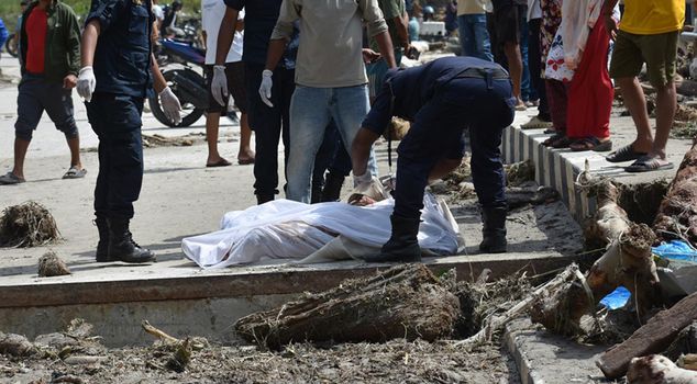
In the disaster that began on Wednesday morning, a massive body of water, mud, and rock engulfed settlements on both sides of the border. While villages and towns along the routes of the Bhote Koshi and Trishuli rivers in Nepal were submerged, images captured by security cameras on the Chinese side showed giant mud waves destroying buildings and people fleeing for their lives. According to the latest official statements from the region, at least 165 people have lost their lives in the disaster.
TOLL WORSENS: HUNDREDS OF TOURISTS AND RESIDENTS MISSING
Although more than twenty-four hours have passed since the disaster, the number of missing persons has reached alarming levels due to the collapse of communication and transportation infrastructure in the region. According to the latest data shared by Nepal's disaster management agency, no contact can be established with a total of 823 people in the country, including 579 Nepali nationals and foreign tourists. Chinese authorities, on the other hand, announced that 558 people, including 260 foreign tourists, are missing in the Tibet region. Among the foreign nationals unreachable in the region are tourists from many different countries, including India, Ukraine, Malaysia, the United Kingdom, South Africa, and Australia.
THE REAL CAUSE OF THE DISASTER REVEALED: NOT AN EARTHQUAKE BUT A GLACIAL COLLAPSE
The claims put forward in the first hours regarding the cause of the massive destruction changed after comprehensive scientific investigations. The event, initially announced as an earthquake-induced landslide by Nepalese authorities and the United States Geological Survey (USGS), was clarified through detailed analysis of seismic waves and satellite imagery. The USGS determined that the seismic movement recorded in the region was not actually an earthquake, but that a massive glacial collapse and debris flow caused the disaster. It was confirmed that the enormous mass breaking off the glacier dragged rocks and debris into the river system, triggering the destructive flood downstream.
INTERNATIONAL COMMUNITY MOBILIZES AID FOR THE REGION
As the extent of the destruction caused by the disaster became clear, the international community sprang into action for the region. Within the scope of the aid mobilization launched, the United States promised an emergency aid package of five hundred thousand dollars, while the International Federation of Red Cross and Red Crescent Societies allocated 1.4 million dollars in resources. To support search and rescue and damage assessment efforts, the European Union announced it had activated its Copernicus satellite system. Additionally, the World Health Organization dispatched emergency medical supplies, while India delivered ten tons of humanitarian aid to the region in the first phase.