01.09.2026 19:10
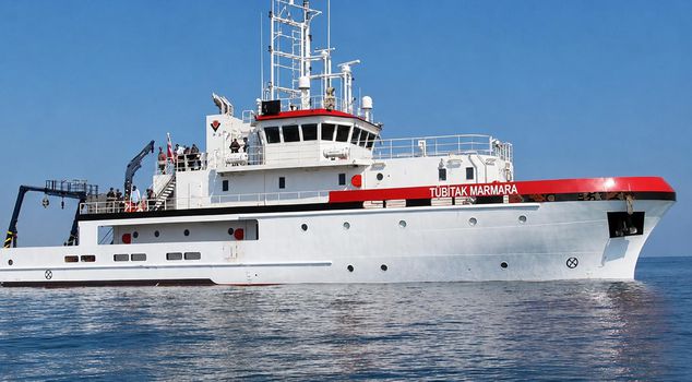
Türkiye announced with a Navtex published yesterday that the research vessel TÜBİTAK Marmara will conduct scientific studies between September 1-15, 2026, in the Eastern Mediterranean off the coast of Meis Island, within Turkish maritime jurisdiction. Greece, on the other hand, issued a counter-Navtex. Athens made a baseless claim that the region where Türkiye will conduct research falls within its own jurisdiction and that permission should have been obtained from it.
Türkiye continues its determination to protect its own resources and maritime jurisdiction areas in the Eastern Mediterranean.
THE "NAVTEX" THAT DROVE GREECE CRAZY
With the new Navtex announcement published, the TÜBİTAK Marmara research vessel is starting its scientific studies in the area off the coast of Meis Island and entirely within the Turkish continental shelf. The activities to be carried out between 1-15 September 2026 mean the de facto implementation of Türkiye's legitimate rights arising from international law.
ATHENS' COUNTER-MOVE DID NOT DELAY
Greece, on the other hand, reiterated its customary unjust objections to the constructive activities in the region. The Athens administration published a Navtex against Türkiye's research activity conducted in its own continental shelf. Greece, citing Meis Island, which is only 2 kilometers from the Anatolian mainland, claimed that the area in question was within its own maritime jurisdiction.
WHAT IS NAVTEX?
Navtex is an international radio broadcasting system that provides mariners with information on navigational safety, meteorological forecasts, hazard warnings, and work areas. Based on the standards of the International Maritime Organization (IMO), this system is published in Türkiye by the Turkish Naval Forces Command, Department of Navigation, Hydrography and Oceanography. Navtex announcements not only broadcast technical navigational information but also constitute one of the most important tools in international law for countries to de facto declare their sovereign rights in their maritime jurisdiction areas through their activities in the field.