18.12.2024 15:51
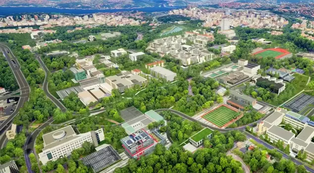
The "3D City Models Production and 3D Cadastre Base Creation Project" initiated by the General Directorate of Land Registry and Cadastre will enable the creation of digital twins of cities, facilitating citizens' access to reliable information about structures. The project will establish infrastructure for smart cities and will be used in disaster management.
Implemented by the General Directorate of Land Registry and Cadastre, the "3D City Models Production and 3D Cadastre Base Layer Creation Project" is set to launch with the new year. With the project that produces digital twins of cities, it will be easier for citizens to access accurate and reliable information about structures.
THE PROJECT WILL ALSO BE EFFECTIVE IN DISASTER MANAGEMENT
The project, which will create an important infrastructure for smart cities, will ensure the identification and tracking of the existing building stock, the production of land registry, cadastre, address, and 3D building data, and its integration with the data of municipalities and other public institutions. The project will also provide benefits in managing disasters such as earthquakes, floods, and landslides. With 3D cadastre, which will accelerate disaster response, it will be possible to intervene early and in the right place during search and rescue operations after a disaster. Additionally, accurate data will be quickly accessible for damage assessment studies.
On the other hand, the difference between land registry records and actual usage will also be identified. Three-dimensional location data, which is necessary for various studies conducted in areas outside of cadastre such as urban planning, land management, engineering projects, tax collection, protection of cultural and natural assets, and environmental protection, will be provided. The project will create an important infrastructure for smart cities.
MONITORING OF BOTH LICENSED AND UNLICENSED BUILDINGS WILL BE POSSIBLE
With the project, the process will be facilitated by increasing the quality of cadastre data, scanning and modeling architectural projects, and creating 3D photogrammetric city models. Additionally, by recording buildings in the land registry from the construction phase, citizens will be relieved from additional bureaucracy.
Thanks to the project, which allows the presentation of information such as area size, facade, and number of rooms with 3D visuals in real estate buying and selling processes, monitoring of both licensed and unlicensed buildings will also be possible. The technological data and outputs obtained can be used in many areas, from the environment to the construction sector.
INFORMATION MEETING HELD
As part of the "3D City Models Production and 3D Cadastre Base Layer Creation" project, an information meeting was held in Tekirdağ by the Edirne Regional Directorate of Land Registry and Cadastre. In the meeting held at the Tekirdağ Land Registry and Cadastre Directorate Meeting Hall, the applications of "application projects" and three-dimensional digital building model applications related to condominium and property rights transactions were explained.
"CREATION OF 3D BUILDING MODELS WILL BECOME MANDATORY"
Edirne Regional Director of Land Registry and Cadastre Hayrullah Akdemir stated that with the project, digital twins of cities are being produced, making it easier for citizens to access accurate and reliable information about structures. Akdemir noted that 3D building data can be produced thanks to the project, saying, "In today's advancing technology, we are experiencing a period where the need for 3D cadastre systems has increased alongside traditional cadastre methods." He expressed that two-dimensional maps have become insufficient due to factors such as increasing urbanization and the intertwining of complex land ownership areas.
"MADE MANDATORY"
Reminding that the project will start in 81 provinces as of January 1, Akdemir said, "'With the motto of 'Turkey Century', as the General Directorate of Land Registry and Cadastre, we have implemented our technology-adopting, solution-oriented approaches in the transition process to 3D cadastre systems in Edirne. Pilot studies are completely finished. With the instructions of our General Directorate, the project for the creation of 3D building models will be spread across Turkey on January 1, 2025, and the creation of 3D building models in condominium and property rights will become mandatory." he stated.
Akdemir emphasized that the 3D cadastre properties play a critical role in the correct management of property rights by ensuring both horizontal and vertical registration. He pointed out the importance of the project as it will shape the future of the country and institutions, stating that they brought stakeholders together in Edirne, Tekirdağ, and Kırklareli and provided necessary information about the related applications. The meeting was attended by Tekirdağ Cadastre Director Namık Kemal Erzurum, Tekirdağ Land Registry Director Serhan Demirbilek, technical personnel from municipalities, personnel from land registry and cadastre directorates, and freelance survey engineers.