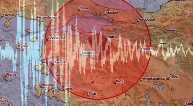
07.10.2025 16:41
Geology expert Prof. Dr. Şener Üşümezsoy made groundbreaking statements regarding the expected Marmara earthquake. Üşümezsoy said, "For an earthquake of magnitude 7.8 to occur in the Marmara region, a surface of 400 km in length and 15 km in depth needs to rupture. The Sea of Marmara has areas that are 150 kilometers long and less than 10 kilometers deep. How can a surface of 10,000 kilometers rupture and cause a major earthquake here?"
```html
According to geological data, the fault line beneath the Sea of Marmara poses one of Turkey's greatest seismic risks. Experts state that there has been no rupture in this section of the North Anatolian Fault for a long time, which has led to a dangerous accumulation of energy. It is emphasized that a possible earthquake in Marmara requires preparation both scientifically and socially. However, Prof. Dr. Şener Üşümezsoy opposes these comments.
"THE NORTH ANATOLIAN FAULT DOES NOT PASS THROUGH THE ISLANDS"
Üşümezsoy reiterated that he does not agree with predictions of earthquakes over magnitude 7 in the Sea of Marmara, providing information about the recent earthquakes that have occurred both in Istanbul and many places across the country. He stated, "After the 1999 earthquake, everyone pointed to the Islands saying 'A big earthquake is coming.' The area we refer to as the Islands has expanded in the north-south direction due to subsidence and consists of extensional structures like the Silivri basin and Tekirdağ basin. This region has formed due to the compression of the North Anatolian Fault from north to south. However, the Islands fault is subsiding due to extension. Therefore, the North Anatolian Fault does not pass through the Islands. It passes through Yalova, from Çınarcık," he said.
"A 7.8 MAGNITUDE EARTHQUAKE REQUIRES 400 KM"
Recalling that the Kahramanmaraş earthquakes that occurred on February 6, 2023, had a length of 400 kilometers starting from Antakya to Pütürge, Prof. Dr. Üşümezsoy stated, "Those who say that a fault will rupture 180 kilometers across the Sea of Marmara and expect an earthquake of magnitude 8 know nothing." Üşümezsoy continued his remarks as follows:
"If a rupture occurs with a diameter of 1 km, it results in a magnitude 4 earthquake; if an area with a diameter of 3 km is ruptured, meaning 10 square kilometers, it results in a magnitude 5 earthquake; if an area of 10 km+10 km, meaning 100 square kilometers, is ruptured, it results in a magnitude 6 earthquake; if an area of 1,000 km is ruptured, it results in a magnitude 7 earthquake; if an area of 10,000 km is ruptured, it results in a magnitude 8 earthquake. If the depth is 10 km, a length of 1,000 km is required. For a magnitude 7.8 earthquake to occur in Marmara, a surface of 400 km in length and 15 km in depth needs to be ruptured. The Sea of Marmara has areas that are 150 kilometers long and not deeper than 10 kilometers. How can a surface of 10,000 kilometers be ruptured here to cause a major earthquake?"
"THE EXPECTED MAJOR EARTHQUAKE IN THE SEA OF MARMARA OCCURRED ON AUGUST 17"
Üşümezsoy, stating that "The 65 km fault in the Sea of Marmara between Yalova and Yeşilköy ruptured in 1894. After it has ruptured once, the stress that causes the earthquake must grow again for it to rupture again," said, "There is a fault that has previously ruptured in the Sea of Marmara. The earthquake we have been waiting for over 100 years occurred on August 17. After this, there is no major fault in the Sea of Marmara as claimed."
```