06.04.2026 11:10
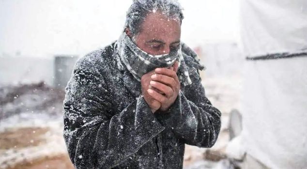
With the cold air wave coming from the Balkans, a temperature drop of 10-15 degrees is expected across Turkey, while heavy rain and strong winds will be effective in many regions. Snowfall and the risk of agricultural frost are anticipated in the interior and eastern parts; it is predicted that the system will lose its effect towards the weekend.
The General Directorate of Meteorology announced that temperatures will suddenly drop by 10-15 degrees with a cold air system coming from the Balkans in mid-April, and it was reported that snow is expected in high areas, frost in agricultural fields, and heavy rainfall along the coasts.
TEMPERATURES WILL DROP RAPIDLY
This week, a severe weather change will occur in Turkey, where spring weather has been felt. According to the assessment of the General Directorate of Meteorology (MGM), the low-pressure system moving from the Balkans will significantly reduce temperatures across the country in a short time. It is expected that temperatures, which are around 20 degrees in Marmara and Aegean regions in the early days of the week, will noticeably decline from the middle of the week.
SINGLE-DIGIT TEMPERATURES IN THE NORTHWEST
It is predicted that temperatures felt in the northwestern provinces, especially in Istanbul, will drop to single digits. The fog that is effective in the morning hours will be replaced by strong winds and heavy rainfall.
HEAVY RAIN ALERT IN THE MEDITERRANEAN AND SOUTHEAST
The rainy system is expected to have its most intense effect in the Mediterranean and Southeastern Anatolia regions. Thunderstorms and heavy rainfall that started around Muğla, Antalya, and Mersin are expected to spread towards the inner regions. In the intersection points of Eastern Anatolia and Southeastern Anatolia, it is stated that the rainfall will be locally strong, which may increase the risk of flooding and waterlogging.
WINTER CONDITIONS RETURNING TO CENTRAL AND EASTERN ANATOLIA
From Thursday, winter conditions will reassert themselves in the central and eastern regions. While nighttime temperatures in Ankara are expected to drop to zero degrees, mixed rain and snow will be seen in the northern part of Central Anatolia and throughout Eastern Anatolia. In regions where nighttime temperatures may drop to minus 7 degrees, there is a risk of agricultural frost for fruit orchards that have bloomed.
HOW WILL THE WEATHER BE IN THE THREE MAJOR CITIES?
In Istanbul, the spring weather approaching 20 degrees will give way to single-digit temperatures, with strong winds and intermittent rainfall being effective. In Ankara, winter conditions will be felt again; nighttime temperatures will drop to zero degrees, and mixed rain and snow will be seen in high areas. In Izmir, the temperature drop will be more limited, but thunderstorms and strong winds may negatively affect daily life.
PROVINCES EXPECTING SNOWFALL
According to meteorological data, heavy snowfall is expected in Eastern Anatolia, especially in Erzurum, Erzincan, Kars, Ardahan, Ağrı, Muş, Bitlis, and Hakkari. In Central Anatolia, snow transitions may be seen along the Sivas, Kayseri, Yozgat, and Çankırı line. Additionally, snowfall will be effective in the high areas of Marmara and the Black Sea, including Bolu Kartalkaya, Kocaeli Kartepe, and Bursa Uludağ. Warnings have been issued for disruptions in transportation in high passes.
SPRING WEATHER WILL RETURN ON THE WEEKEND
It is expected that the cold wave will lose its effect towards the weekend and that temperatures will gradually return to seasonal norms. After April 15, especially in the western regions, temperatures are predicted to rise again to the 16-20 degree range. However, it is stated that nighttime frosts will continue for a while in the central and eastern regions, and permanent spring temperatures will be felt in the last week of April.
RAINS WILL LAST FOR 4 DAYS
The rainy system expected to enter from Marmara on Wednesday is reported to increase its effect by spreading to the central and eastern regions on Thursday and Friday. The rains, which will continue intermittently until the weekend, are expected to lose their effect starting from Saturday evening from the west and to leave the country on Sunday.